James Douglas Coleman STUDIO

About
  • Contact
  • Bio
  • Texts
  • News
  • Projects
  • Element of the Duel
  • Signatures of Invisible Persons
  • Fractions of a Square Kilometer
  • L Within R; R Within L
  • Geometry Surveyed on Topography: Gloucester, MA
  • Reenactment
  • Geometry Surveyed on Topography: Endicott, NY
  • Element Of The Duel
    Biofouling refers to the accumulation of calcareous sealife onto the hull of a ship, resulting in structural deterioration and increased drag. In the 18th century, copper sheathing’s slippery and ductile quality proved to be a practical solution, and its application would evolve into copper-based anti-fouling paints.

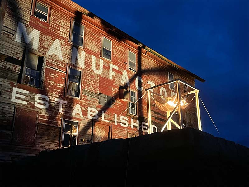
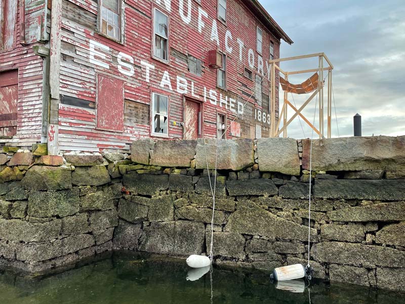
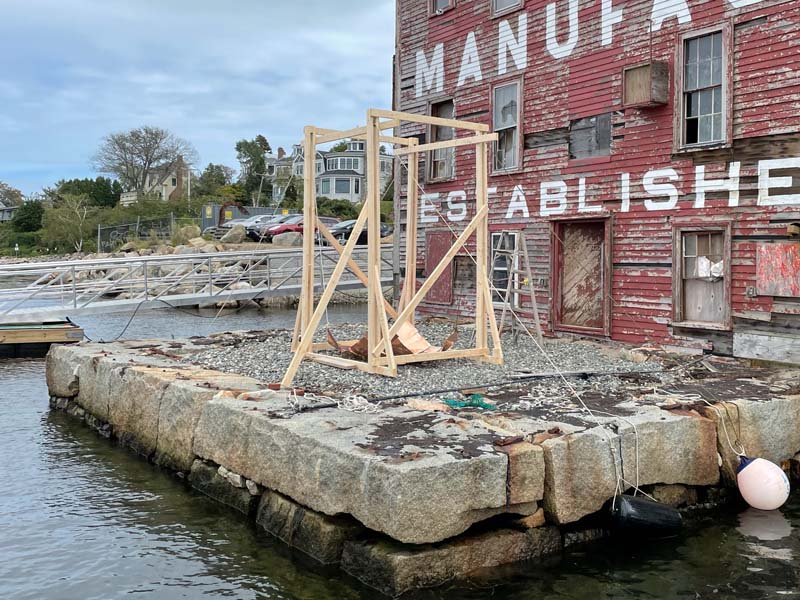
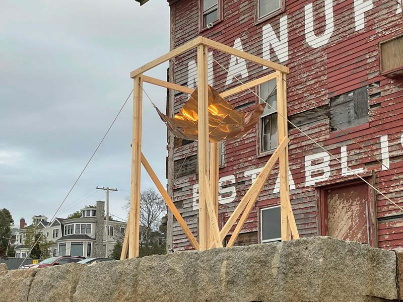
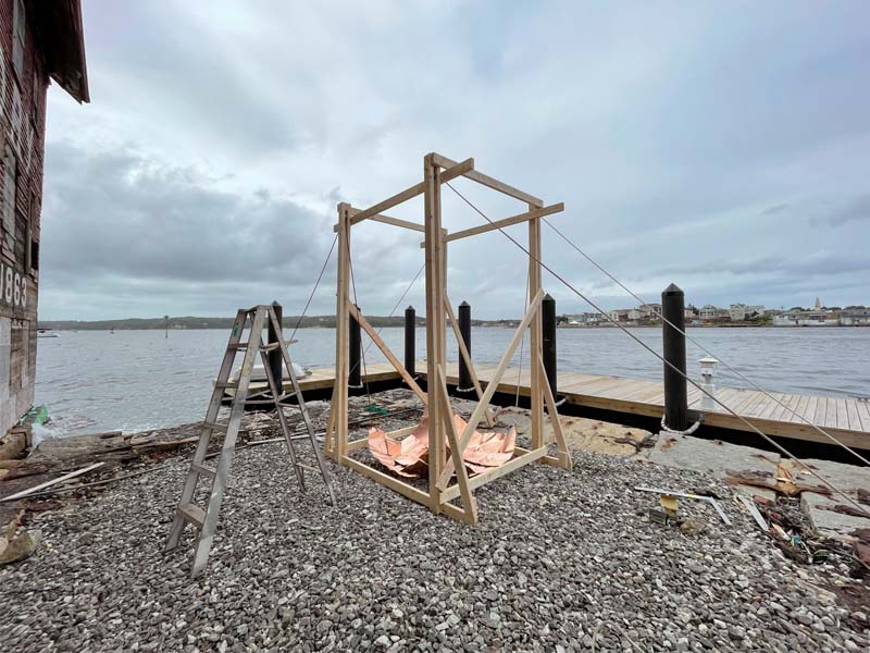
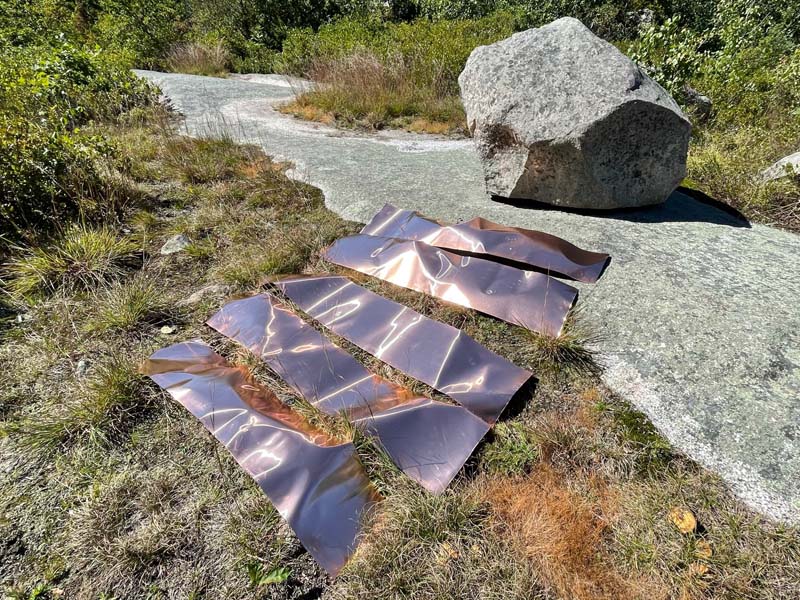
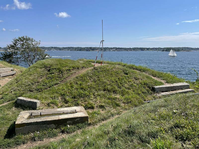
    The site is both the location of the first manufacturing plant of copper-based anti-fouling paint (1863) and the first contact between European explorers and Gloucester’s indigenous peoples (1623).

    Copper sheathing was hand-formed to the shape of the “gnomon” stone which marks the central observation point of a local ancient indigenous hilltop observatory. The formed vessel of copper sheathing was then inverted and hung via a scaffold at the site of first contact. The vessel’s relative height is determined by the tide: when the tide is low and the vessel hangs high, it retains the form of the rock. When the tide is high the vessel is lowered to the gravel below and loses its referential figure.

    Copper, wood, rope, found flotations. Gloucester, MA. 2021.

    Signatures Of Invisible Persons (series)
    Digital Video. Jena, GE, Waterloo, BE, Brno, CZ. 2019-.
    Fractions of a Square Kilometer

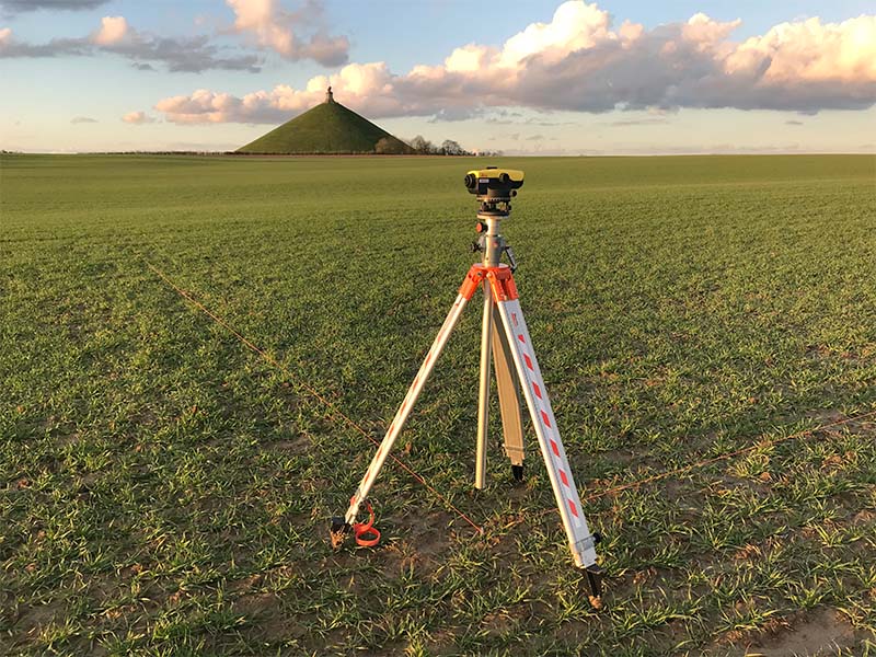
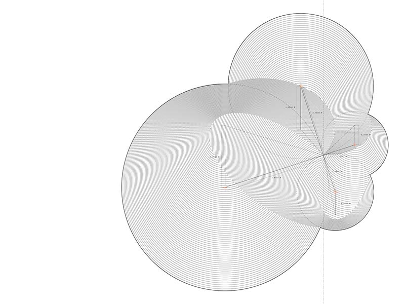
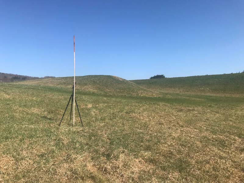
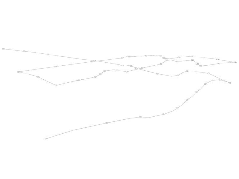
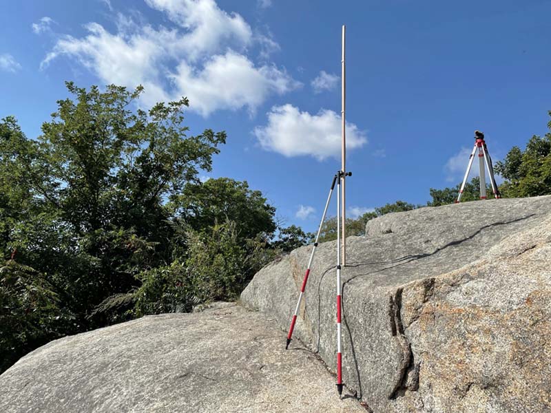
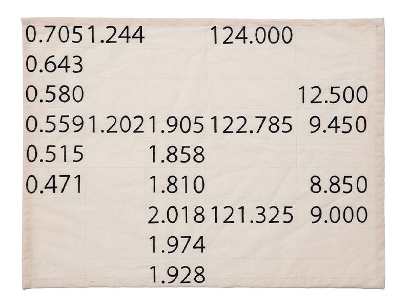
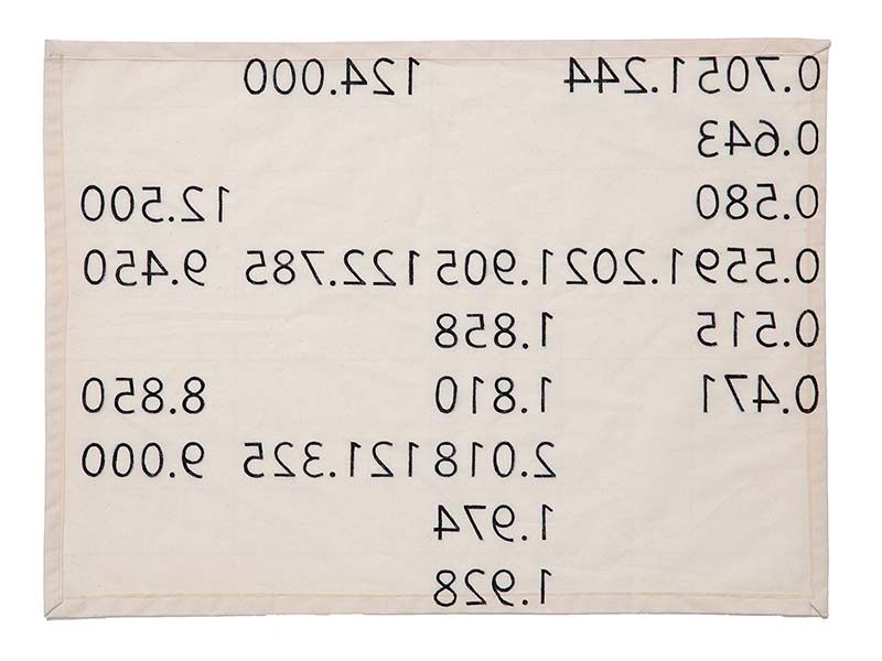
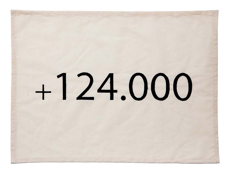
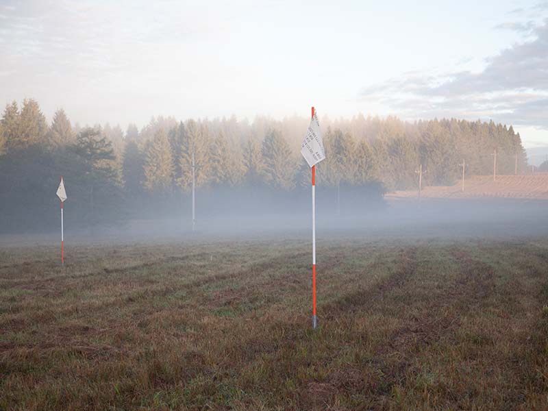
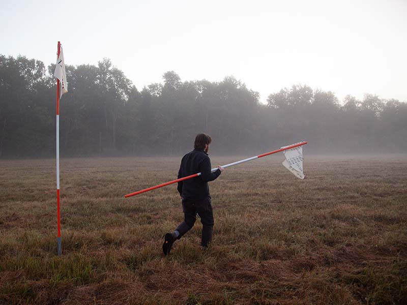
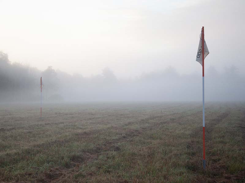
    A kilometer square was drawn surrounding two major panoramic observational devices on the Waterloo battlefield. The Lion’s Mound is a 43-meter tall earthen observation hill constructed immediately following the battle from 1822-1825. The adjacent rotund building was designed to house the panorama painting depicting the scene of the battle by artist Louis Dumoulin in 1912. The square was surveyed using differential leveling survey techniques and the resulting data was recorded and formatted into topographic sections, then mathematically transformed through the shared circle of reflection between the two observational elements to establish the base geometry for a final proposed monument.

    Survey data. Waterloo, BE, 2019

    l within r; r within l
    By assigning sidedness to a line, the points that describe it no longer refer merely to their position and by extension, the line’s length, but anthropomorphize the line into a front and back, left and right. The flag signified these anthropomorphic characteristics overlayed onto the geometry and orientation within the field. The flags themselves are isolated as markers of the geometry and, through the manipulation of their relative positions, cause the form to undergo a series of geometric translations.

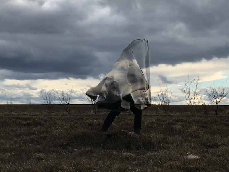
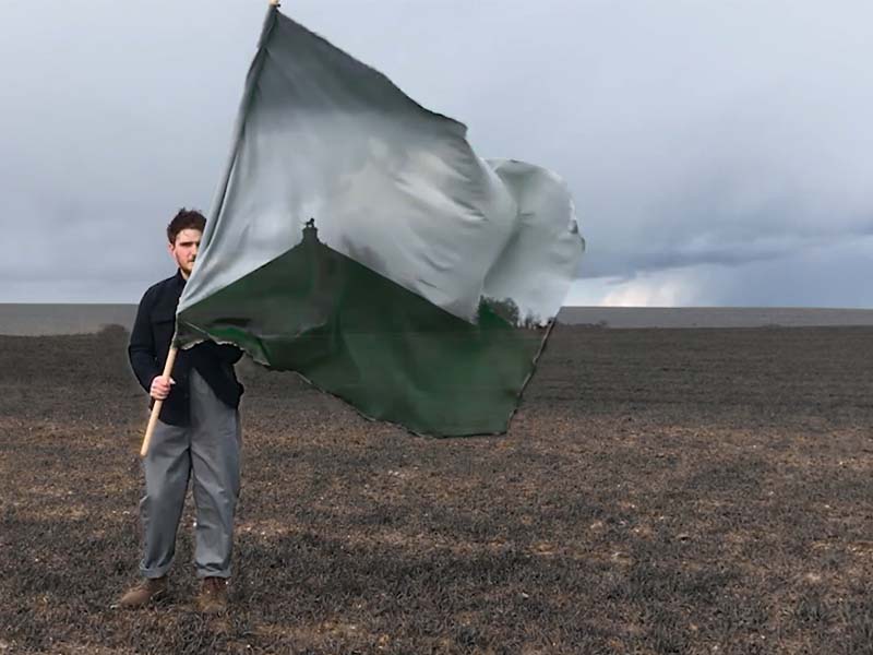
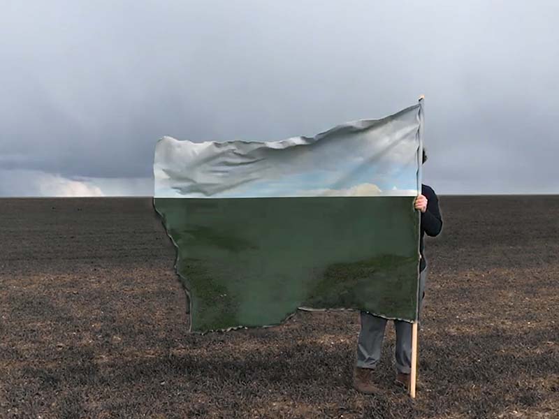
    Site choreography, video. Waterloo, BE. 2019.

    Geometry Surveyed On Topography
    Survey Data. Gloucester, MA. 2021.
    Reenactment
    Sets of survey data from various projects were used to build a choreography that would interact with pre-existing infrastructural elements within a neutral site. Data was used to encode flags that functioned as position markers throughout the process.

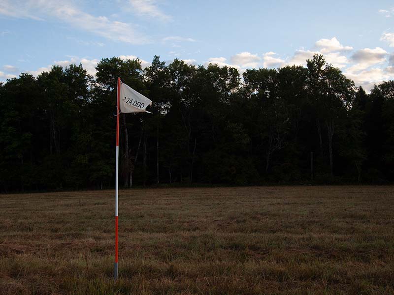
    Site choreography, survey data. Long Pond, NY. 2020.

    Come With Your Own Uniform
    Edited Digital Video. 2020.
    Geometry Surveyed On Topography
    Survey Data. Gloucester, MA. 2021.